When evaluating the best ai property inspection software, manual building envelope audits are quietly draining operating budgets. Setting up swing stages, suspended scaffolding, or boom lifts to inspect high-rise facades and expansive roof decks exposes field crews to severe fall hazards and costs thousands of dollars per deployment. Worst of all, manual inspections leave asset managers with fragmented binders of unreferenced 2D photos that fail to track structural deterioration over time.
Autonomous drone platforms paired with computer vision have shifted building condition assessments from subjective visual spot-checks into verifiable spatial datasets. Today’s reality capture pipelines combine autonomous flight trajectories, radiometric thermography, and deep learning defect detection to build millimeter-accurate digital twins of commercial and multi-family properties.
The challenge is no longer getting a drone into the air. The challenge is selecting an enterprise data platform that fits your property portfolio, minimizes inspection turnaround times, and integrates directly into your existing maintenance and claims workflows.
2026 AI Property Inspection Software Platform Comparison
| Platform | Best For | Flight & Autonomy Model | Standout Defect AI | Core Enterprise Integrations | Starting Price / Model |
| Skydio 3D Scan & X10 | High-rise facades & GPS-denied urban canyons | 360° optical SLAM; autonomous surface-hugging flight | Sub-millimeter geometric crack mapping | Esri ArcGIS, Axon, Autodesk, REST APIs | ~$2,999/yr software add-on (Hardware: $15K–$22K) |
| DroneDeploy (Procore) | Large multi-family & commercial portfolios | Automated grid/orbit capture; autonomous dock support | Inspection AI (facade, roof, safety compliance) | Procore, Autodesk Construction Cloud, Yardi, Esri | ~$4,188/yr (Individual); custom enterprise tiers |
| Loveland IMGING | Property insurance carriers & roofing contractors | Automated facet-by-facet roof flight execution | Hail strikes, wind uplift, automated test squares | Xactimate, Guidewire, CAD formats | ~$669/mo per seat (full AI flight suite) |
| Kespry Platform | Multi-asset commercial portfolios & industrial roofs | Single-button automated mission capture | Thermal moisture detection & volumetric modeling | Commercial ERPs, Esri GIS, DXF exports | Custom annual enterprise subscription |
| Optelos + Bentley iTwin | Engineering consultancies & high-risk infrastructure | Hardware-agnostic visual data ingestion | Zero-Code custom AI + iTwin concrete/steel defect library | ServiceNow, SAP, Salesforce, Bentley iTwin | Custom quote based on storage & AI seat count |
Technical Evaluation of the Top 5 Platforms
1. Skydio 3D Scan & X10 Platform
Best for: High-rise towers, dense urban corridors, and GPS-compromised structural envelopes.
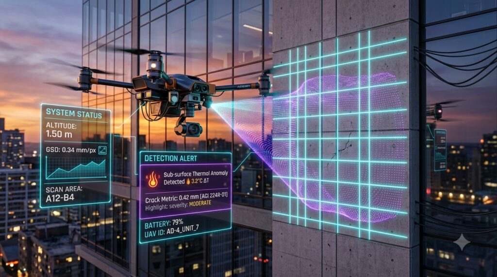
Skydio decouples flight safety from satellite availability. Operating in urban canyons often leads to severe GPS multi-path errors, causing standard drones to drift dangerously close to structures. The Skydio X10 airframe relies on a six-camera navigation array running real-time visual Simultaneous Localization and Mapping (SLAM). This allows the drone to hold a steady 1.5-meter standoff distance from concrete, structural steel, or glass curtain walls without visual observers or manual stick inputs.
Instead of running rigid pre-programmed grid flights, Skydio 3D Scan iteratively models the structure in real time, automatically planning camera angles to maintain a uniform Ground Sample Distance (GSD). At close range, its 65MP sensor resolves micro-cracks down to 0.65 mm per pixel.
- Pros: Industry-leading GPS-denied obstacle avoidance; safe ultra-close facade capture; automated 3D volumetric model generation.
- Cons: Premium hardware acquisition cost; proprietary capture software requires Skydio hardware.
Editor’s Take: If your portfolio contains high-rise urban assets with complex geometry, Skydio provides the lowest collision risk on the market. If you only inspect low-slope, single-story suburban retail roofs, the advanced SLAM hardware is unnecessary overhead.
2. DroneDeploy (with Procore Ecosystem Integration)
Best for: Commercial real estate asset managers and general contractors tracking portfolio-wide asset health.
DroneDeploy serves as a centralized reality capture engine, ingesting data from aerial drones, automated dock stations, ground-based 360-degree cameras, and handheld LiDAR. Now deeply embedded within the Procore ecosystem, visual field captures automatically sync with project records, maintenance logs, and financial budgets.
The platform’s Inspection AI engine automates visual triage across thousands of images, flagging membrane tears, ponding water, and thermal heat loss across massive commercial roofs. For ongoing operations, scheduled docked drone flights run recurring roof audits without requiring an on-site pilot.
- Pros: Broad enterprise integrations (Procore, Autodesk, Yardi); unified ground and aerial reality capture; automated dock management.
- Cons: Advanced defect detection and automated GCP alignment require upper-tier enterprise plans; processing large photogrammetry datasets can introduce cloud queue latency.
Editor’s Take: Choose DroneDeploy if your organization wants a single platform for both ground walkthroughs and aerial envelope audits. Teams needing specialized insurance claim exports, however, will find its out-of-the-box damage quantification less targeted than specialized roofing tools.
3. Loveland Innovations (IMGING Platform)
Best for: Property insurance adjusters, claims managers, and commercial roofing contractors.
Loveland Innovations built IMGING specifically around property condition assessments, roof damage quantification, and insurance workflows. Paired with enterprise drones like the DJI Mavic 3 Enterprise, IMGING Flight executes automated, facet-by-facet sweeps that maintain constant slant-range distances to steep pitches and complex parapets.
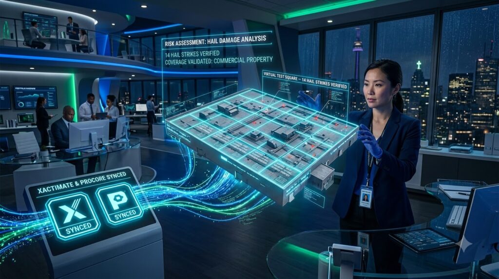
The platform’s neural network focuses heavily on roof degradation, automatically identifying hail impacts, wind creases, missing fasteners, and mechanical punctures. Its patented Virtual Test Squares feature places standardized 10-by-10-foot digital evaluation areas across roof facets to compute objective, audit-proof loss ratios that sync directly into Xactimate and Guidewire.
- Pros: Highly accurate roof-specific AI defect classification; native Xactimate and Guidewire integration; automated scope-of-loss reporting.
- Cons: Narrow focus on roof envelopes rather than whole-building structural twins; flight automation is limited to specific supported drone models.
Editor’s Take: If your primary operational KPI is shortening insurance claim cycles or producing defensible roof replacement estimates, IMGING is the fastest path to positive ROI. It is not designed to replace engineering-grade finite element modeling tools.
4. Kespry Aerial Intelligence Platform
Best for: Corporate facility managers and enterprise real estate teams seeking push-button simplicity.
Kespry focuses on operational simplicity, allowing property teams to conduct standardized roof and site audits with minimal training. Field personnel define the project perimeter on a tablet, and the system automates flight planning, take-off, data collection, and cloud upload.
The cloud engine generates high-resolution 2D orthomosaics, digital elevation models, and radiometric thermal maps. It excels at detecting commercial roof degradation, highlighting sub-surface insulation moisture traps, measuring pitch variations, and calculating drainage catchment areas.
- Pros: Straightforward single-button mission planning; rapid thermal map rendering; strong portfolio-level reporting tools.
- Cons: Limited facade-tracking capabilities compared to dedicated SLAM engines; API extensibility is more restrictive than open data platforms.
Editor’s Take: Kespry is a practical choice for organizations operating internal, non-specialist flight teams across distributed suburban commercial parks. Engineering firms requiring deep facade crack telemetry should consider open-architecture alternatives.
5. Optelos Visual Data Management & Bentley iTwin Capture
Best for: Structural engineering consultancies, industrial asset owners, and forensic auditors.
Optelos is a hardware-agnostic visual data management engine that organizes unstructured imagery from any drone, fixed sensor, or ground rover into an indexed geospatial database. Through its integration with Bentley iTwin Capture, Optelos processes photogrammetric data into engineering-grade 3D reality meshes capable of structural health monitoring.
Its primary differentiator is a Zero-Code AI engine. Engineering teams can upload proprietary labeled images to train custom computer vision models for specific structural anomalies, such as concrete carbonation, rebar corrosion, or stone joint failure. REST APIs push verified defect tickets directly into enterprise systems like ServiceNow and SAP.
- Pros: Complete hardware and sensor independence; customizable AI model training; engineering-grade 3D mesh accuracy.
- Cons: Requires higher internal technical setup; pricing scales with storage volume and bespoke AI deployments.
Editor’s Take: Optelos is the premier platform for engineering teams that cannot rely on generic defect classifiers. If you need bespoke computer vision models mapped directly to SAP maintenance logs, this is the appropriate architectural choice.
The Physics of Autonomous Defect Detection
Accurately evaluating structural integrity requires measuring exterior concrete and masonry crack widths to verify compliance with standards like ACI 224R-01. Cracks narrower than 0.3 mm represent low immediate risk, while openings between 0.3 mm and 0.5 mm allow water ingress that accelerates freeze-thaw spalling. Openings wider than 1.0 mm compromise internal shear capacity.
Ground Sample Distance (GSD) Formula:
GSD = (Sensor Width [mm] × Standoff Distance [mm]) / (Focal Length [mm] × Image Width [px])
• At 10m standoff (Standard Grid): (13.2 × 10,000) / (10.57 × 5,472) ≈ 2.28 mm/pixel (Sub-millimeter micro-cracks cannot be resolved).
• At 1.5m standoff (Autonomous SLAM): (13.2 × 1,500) / (10.57 × 5,472) ≈ 0.34 mm/pixel (Enables sub-pixel crack measurement down to 0.1 mm).
At 2.28 mm/pixel (flying at a 10-meter standoff distance), a 0.5 mm structural crack occupies only a fraction of a single pixel, making optical defect measurement impossible due to spatial blur.
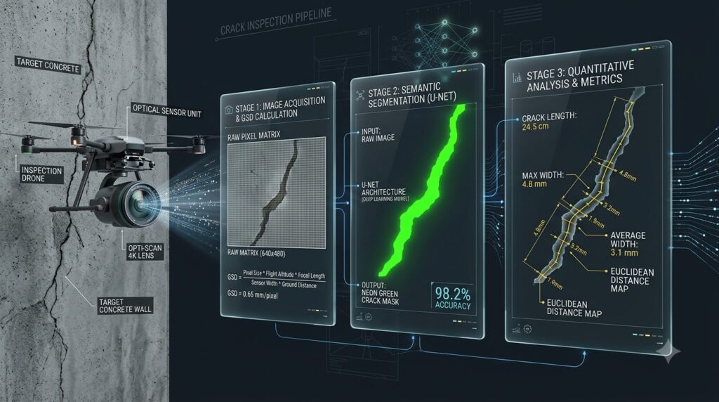
Leading ai property inspection software platforms resolve sub-millimeter defects through a specialized four-stage pipeline:
- Ultra-Close Autonomous Flight: SLAM-guided navigation holds a steady 1.5-meter standoff distance from the building facade, dropping Ground Sample Distance (GSD) below 0.34 mm/pixel.
- Super-Resolution Processing: Real-ESRGAN deep learning algorithms reconstruct high-frequency edge data from raw pixels, reducing crack width measurement variance from 140% down to under 10%.
- Semantic Segmentation: Specialized neural networks (such as U-Net architectures) isolate crack geometries directly from background concrete textures.
- Sub-Pixel Edge Metrics: Euclidean Distance Transforms evaluate orthogonal profiles along the defect’s centerline, measuring crack widths down to 0.1 mm accuracy for compliance with ACI 224R-01 structural guidelines.
Radiometric Thermography & Envelope Thermodynamics
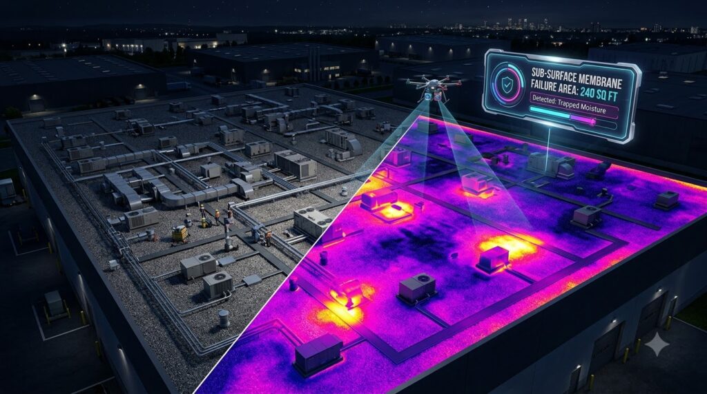
Drone-based thermography uses Long-Wave Infrared (LWIR) radiometric sensors (7.5 to 14 µm wavelength) coregistered with visual RGB imagery to diagnose sub-surface envelope failures. Leading ai property inspection software models analyze these thermal differentials to detect latent moisture intrusion before physical structural spalling occurs.
| Envelope Anomaly | Physical Root Cause | Diagnostic LWIR Signature |
| Moisture Entrapment | Membrane puncture; saturated insulation | High thermal mass signature during evening cooling cycles |
| Thermal Bridging | Missing insulation; uninsulated structural tie-ins | Linear conduction paths showing continuous heat loss |
| Air Leakage | Degraded window gaskets; expansion joint gaps | Plume-shaped differential temperature plumes at structural seams |
Water has a significantly higher specific heat capacity than dry polyisocyanurate insulation. During daytime hours, saturated insulation absorbs thermal energy slowly. As ambient temperatures drop at dusk, wet insulation sections retain and radiate heat far longer than adjacent dry areas. Radiometric engines isolate these thermal anomalies, allowing property managers to execute surgical patch repairs instead of funding premature, million-dollar roof replacements.
Commercial ROI: Insurance, Claims, and Safety
Adopting AI-driven visual data pipelines delivers measurable financial returns across three main pillars:
- Lower Underwriting Premiums: Presenting underwriters with high-resolution digital baselines eliminates disputes over pre-existing damage, securing preferred risk tiers and lowering property insurance premiums.
- Accelerated Claim Recovery: Following major storm events, automated damage detection engines isolate hail strikes and produce standardized 10-by-10-foot Virtual Test Squares within hours. Exporting structured scopes of loss directly into Xactimate cuts settlement timelines from months to days.
- Reduced Workplace Liability: Transitioning visual inspections to autonomous drones removes human inspectors from ladders, boom lifts, and swing stages. Mitigating fall hazards reduces an organization’s Experience Modification Rate (EMR), directly lowering workers’ compensation insurance premiums.
Regulatory Compliance & Operations
Deploying autonomous inspection drones across multi-family residential complexes and urban commercial centers requires adhering to strict operational protocols:
- FAA Part 107 Compliance: Flying over non-participating individuals or moving vehicles requires aircraft that meet FAA Category 1–4 guidelines, often utilizing prop guards or certified parachute recovery systems. Urban operations leverage automated LAANC integrations to secure controlled airspace clearances in real time.
- BVLOS and Obstacle Avoidance: Extended structural inspections that break direct visual sightlines rely on validated 360-degree collision-avoidance systems (such as Skydio’s optical array) to mitigate ground-risk parameters.
- Resident Privacy Safeguards: Multi-family deployments demand strict visual privacy protection. Modern cloud pipelines automatically apply AI-driven blur filters over human faces, license plates, and residential window interiors before publishing 3D models or public reports.
Strategic Buyer Advice
- Choose Skydio 3D Scan & X10 if your primary assets are high-rise urban structures or facilities with severe GPS interference requiring sub-millimeter facade crack audits.
- Choose DroneDeploy Enterprise if you oversee large multi-family or commercial real estate portfolios and require a unified platform for aerial, 360 ground walk, and construction management workflows via Procore.
- Choose Loveland IMGING if you manage property insurance adjusting or commercial roofing programs where rapid damage quantification and Xactimate exports drive operational ROI.
- Choose Optelos + Bentley iTwin if you are an engineering consultancy needing bespoke, user-trained AI defect models paired with CAD/GIS reality meshes.
🔍 Related PropTech, Building Safety & Enterprise AI Guides
For commercial facility managers, structural engineers, and HOA asset committees implementing digital envelope diagnostics, explore our related technical benchmarks:
- Milestone Structural Engineering Mandates: Learn how aerial photogrammetry satisfies Florida building safety laws in our Florida SB 4-D Compliance Guide: AI Milestone Inspections.
- Automated Community Violation Systems: Discover how computer vision dashcams streamline field audits in Automated HOA Violation Enforcement & Computer Vision Architecture.
- Operational Benchmark & ROI Study: Compare manual clipboard drive-bys against automated vehicle capture in Manual vs. AI Property Inspections: Cost & Time Benchmark.
- Private Community AI & Resident Privacy: Protect building blueprint files and resident data in Air-Gapped AI for HOA Management & Data Governance.
- Multi-Entity Asset Accounting: Consolidate capital reserve budgeting across property portfolios in Joiin Review 2026: Multi-Entity Financial Reporting.
References
- Federal Aviation Administration: FAA Part 107 Small Unmanned Aircraft Systems Regulations
- American Concrete Institute: ACI 224R-01: Control of Cracking in Concrete Structures
- Skydio Autonomous Systems: Skydio 3D Scan Autonomous Inspection Engine
- Procore Technologies: Procore and DroneDeploy Visual Reality Capture Platform
- Loveland Innovations: IMGING Property Damage Detection & Inspection Platform
- Bentley Systems: Bentley iTwin Capture Reality Modeling Solutions
- Optelos Enterprise Data Management: Optelos Visual Data Management & Custom AI Analytics
- MDPI Research: A Crack Width Measurement Method of UAV Images Using High-Resolution Algorithms